Geography
Curriculum Leader: Carley Ferguson
Miss Ferguson is our geography leader and is responsible for this curriculum area. This means ensuring we teach an ambitious curriculum, supporting our teachers in implementing our curriculum through high-quality lessons and checking that lessons help our children know more, remember more, and do more.
Purpose of study
A high-quality geography education should inspire in pupils a curiosity and fascination about the world and its people that will remain with them for the rest of their lives. Teaching should equip pupils with knowledge about diverse places, people, resources and natural and human environments, together with a deep understanding of the Earth’s key physical and human processes. As pupils progress, their growing knowledge about the world should help them to deepen their understanding of the interaction between physical and human processes, and of the formation and use of landscapes and environments. Geographical knowledge, understanding and skills provide the frameworks and approaches that explain how the Earth’s features at different scales are shaped, interconnected and change over time.
Aims
The national curriculum for geography aims to ensure that all pupils:
- develop contextual knowledge of the location of globally significant places – both terrestrial and marine – including their defining physical and human characteristics and how these provide a geographical context for understanding the actions of processes
- understand the processes that give rise to key physical and human geographical features of the world, how these are interdependent and how they bring about spatial variation and change over time
- are competent in the geographical skills needed to:
- collect, analyse and communicate with a range of data gathered through experiences of fieldwork that deepen their understanding of geographical processes
- interpret a range of sources of geographical information, including maps, diagrams, globes, aerial photographs and Geographical Information Systems (GIS)
- communicate geographical information in a variety of ways, including through maps, numerical and quantitative skills and writing at length.
Intent
We are setting out to help our pupils be ...
- Secure. To find their place in the world and understand how the world works (physical processes and natural features).
- Understanding Love the world and where they live. Protect the world and take care of the environment.
- Resilient. Children learn that it’s okay to make mistakes in geography in order to become resilient geographers.
- Practical. Have fun and inspiring lessons for the children to enjoy. Children learn through practical, hands-on experiences in and outside the classroom. They are inquisitive.
Implementation
We will do this by ensuring ...
- Children are taught a broad curriculum with enrichment opportunities.
- Children are encouraged to gather data and draw conclusions from enquiries.
- We will provide children with time to explore and experiment with new equipment first.
- Children use a range of geographical resources to become familiar with places and landmarks outside the UK.
Impact
We will have made a difference when ...
- Children are curious about the world - they ask questions and set themselves enquiries. They ask to explore the local world they live in.
- Children value and enjoy geography learning - they know how to protect the planet and their importance in doing so.
- They will take pride in their learning, as they have refined and learned from their mistakes. Children will be able to reason and draw examples of geographical features.
- Children can use the resources confidently - they can locate significant places on a map.
Our children will be taught to...
Year R
-
In Year R, children are encouraged to explore and understand their immediate environment. They are taught to describe their surroundings using knowledge gained from observation, discussion, stories, non-fiction texts, and maps.
-
Through these experiences, children develop an understanding of their local community and the world around them. They learn about the similarities and differences between life in their country and other countries, drawing on knowledge from stories, non-fiction texts, and maps.
-
Children also learn about the natural world and the changes that occur throughout the year, including the seasons. They are taught to identify and describe some of the similarities and differences between the natural world around them and contrasting environments, drawing on their experiences and what they have learned in class.
-
Through this learning, children develop an appreciation of the natural world and its importance. They also develop their language and communication skills, as well as their understanding of geography and science.
Key Stage 1
In Key Stage 1, each autumn term begins with essential skills and knowledge projects (Our Wonderful World in Year 1 and Let’s Explore the World in Year 2). Teaching these projects in Years 1 and 2 enables children to be introduced to, or revisit, critical geographical concepts, aspects, skills and knowledge. These projects prepare children for the study of more thematic geography projects in the following term.
Year 1
In the spring term, children study the project Bright Lights, Big City. This project introduces children to the geography of urban environments and the physical and human features of the United Kingdom.
Year 2
In contrast, in the spring term, children carry out a detailed study of coastal geography in the project Coastline. This project introduces children to the geography of coastal environments and provides children with the opportunity for in-depth coastal fieldwork.
Lower Key Stage 2
In Lower Key Stage 2, children begin with essential skills and knowledge projects (One Planet, Our World in Year 3 and Interconnected World in Year 4). Teaching these projects in Years 3 and 4 enables children to further develop their skills, knowledge and understanding of key geographical aspects and concepts and prepares them to study more thematic geography projects in the following term.
Year 3
In the spring term, children study the project Rocks, Relics and Rumbles, which explores physical features and geographical phenomena, including earthquakes and volcanoes.
Year 4
In contrast, in the spring term, children carry out a detailed study of the physical features of mountains and rivers, which includes opportunities for in-depth fieldwork.
Upper Key Stage 2
In Upper Key Stage 2, children again begin with essential skills and knowledge projects (Investigating Our World in Year 5 and Our Changing World in Year 6). Teaching these projects in Years 5 and 6 enables children to develop their skills, knowledge and understanding of key geographical aspects and concepts and prepares them to study more thematic geography projects in the following term.
Year 5
In the spring term, children study the seasonal project Sow, Grow and Farm, which explores farming, agriculture and rural land use.
Year 6
In the spring term, children study the polar regions in the project Frozen Kingdoms. The project includes an in-depth analysis of the characteristics of these regions, including environmental issues.
Units of work
Year 1
Year 1 - Autumn 1Local Explorers During this project, children will learn what geography is and how it helps us understand the world around us. They will begin by identifying physical and human features and exploring simple maps, including one with a key. They will then use positional and directional language, including the cardinal compass points, to describe locations, give directions and follow routes. Finally, they will investigate local human and physical features through simple fieldwork, using their observations and data to build a clearer picture of their environment. |
|
Year 1 - Spring 1City Explorers During this project, children will learn what a landmark is and why certain places become important to people and communities. They will begin by sorting famous landmarks from around the world, then study a local landmark, learning about its location, form and story. Next, they will explore famous London landmarks, aerial photographs and simple picture maps to identify features, follow routes and locate places. Finally, they will create visitor information about London’s landmarks. |
|
Year 1 - Summer 1Global Explorers During this project, the children will identify Earth’s seven continents and five oceans. They will explore where hot and cold places are found and how climate links to location on a world map or globe. They will then focus on the United Kingdom, identifying its four countries and key features. Using aerial images, maps and globes, they will compare human and physical features. Finally, they will investigate a chosen country and compare it with the country where they live. |
Year 2
Year 2 - Autumn 1Map Masters During this project, children will learn what an atlas is and how it helps us find places around the world. They will use the four cardinal compass points to follow and give directions and will learn how map keys use symbols to show important features. They will then apply these skills to maps of their school grounds. Through simple fieldwork, they will observe, record and discuss how areas around school are used. Finally, they will use online mapping tools to explore the local area. |
|
Year 2 - Spring 1Journey to the Coast During this project, children will learn where the United Kingdom is located and will explore the physical and human features of the British coastline. They will use maps to investigate features such as cliffs, beaches, harbours and seaside settlements. They will then explore tourism, considering why people visit coastal areas and how the coast shapes a place's features and character. Finally, they will design an imaginary coastal town, choosing features, services and attractions that would appeal to tourists. |
|
Year 2 - Summer 1Places, People and the Planet During this project, children will learn where the equator is and how it helps us understand the world’s hot, cold and temperate regions. They will investigate the geographical features of the United Kingdom, including landscapes, weather patterns and human and physical characteristics. They will then compare the UK with Somalia, identifying similarities and differences in climate, environment and ways of life. Finally, they will explore how places can be cared for and protected and will learn simple ways to help look after the planet. |
Year 3 - We are currently updating these units over the year 2026/27
Year 3 - Autumn 2Land Use Detectives During this project, children will explore the UK’s human and physical features using digital maps, then investigate key features of its counties and cities across all four countries. They will then study land use, including five major types, before completing fieldwork around the school to find out how local land is used. Finally, they will consolidate their learning to build a clear understanding of the structure of the UK and its physical and human features. |
|
Year 3 - Spring 1Europe Explorers |
|
Year 3 - Summer 2Planet Power
|
Year 4 - We are currently updating these units over the year 2026/27
Year 4 - Autumn 1Adventures Across the Americas During this project, children will explore North and South America using maps, atlases, globes and online mapping tools. They will identify countries, investigate climate zones and research one country in depth. They will compare the Sierra Nevada, Lake District and Alps, before planning a route across the Americas visiting key human and physical features. Finally, they will write an explorer’s log, share their work and answer the project question. |
|
Year 4 - Spring 2Rivers: From Source to Sea |
|
Year 4 - Summer 1Mighty Mountains
|
Year 5
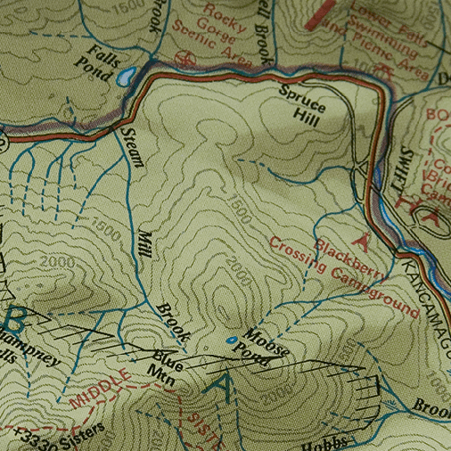 |
Year 5 AutumnInvestigating Our World This essential skills and knowledge project teaches children about locating map features using a range of methods. They learn about the Prime Meridian, Greenwich Mean Time (GMT), and worldwide time zones and study interconnected climate zones, vegetation belts and biomes. Children learn about human geography and capital cities worldwide before looking at the UK motorway network and settlements. They carry out an enquiry to identify local settlement types. |
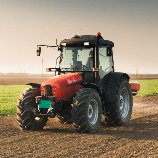 |
Year 5 SpringSow, Grow and Farm This project teaches children about the features and characteristics of land use in agricultural regions across the world, including a detailed exploration of significant environmental areas. |
Year 6
 |
Year 6 AutumnOur Changing World This essential skills and knowledge project revises the features of Earth, time zones and lines of latitude and longitude to pinpoint places on a map. Children find out more about map scales, grid references, contour lines and map symbols. They learn about climate change and the importance of global trade. Children analyse data and carry out fieldwork to find out about local road safety. They study patterns of human settlements and carry out an enquiry to describe local settlement patterns. |
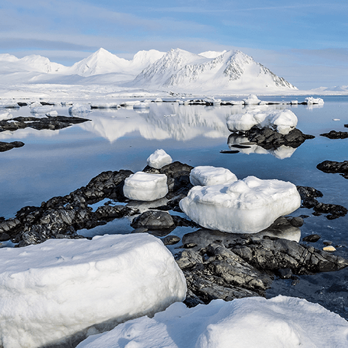 |
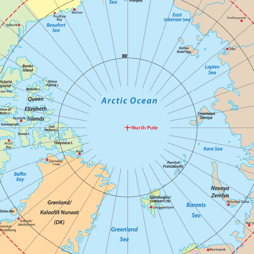
Year 6 SpringFrozen Kingdoms This project teaches children about the characteristics and features of polar regions, including the North and South Poles, and includes a detailed exploration of the environmental factors that shape and influence them. |